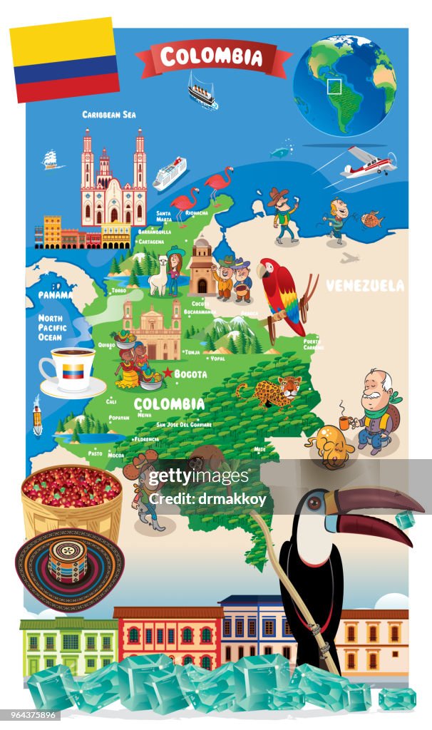
Tecknad karta över Colombia - Bildbanksillustration
Cartoon map of Colombia
Earth
I have used
http://legacy.lib.utexas.edu/maps/world_maps/world_physical_2015.pdf
http://legacy.lib.utexas.edu/maps/americas/colombia_physio-2008.jpg address as the reference to draw the basic map outlines with Illustrator CS5 software, other themes were created by
myself.

Få denna bild med flera olika inramningsalternativ på Photos.com.
KÖP EN LICENS
Alla royaltyfria licenser inkluderar globala användningsrättigheter, omfattande skydd, enkel prissättning med volymrabatter tillgängliga
kr 4,200.00
SEK
INFORMATION
Upphovsman:
Kreativ fil nr:
964375896
Licenstyp:
Samling:
DigitalVision Vectors
Högsta tillåtna filstorlek:
4137 x 6991 bpkt (35,03 x 59,19 cm) - 300 dpi - 22 MB
Uppladdningsdatum:
Plats:
Colombia
Releaseinformation:
Ingen release krävs
Kategorier:
- Colombia,
- Karta,
- Bogotá,
- Peru,
- Vektor,
- Cartagena - Colombia,
- Global,
- Turist,
- Amerikansk kultur,
- Barranquilla,
- Cúcuta,
- Design,
- Flerfärgad,
- Fågel,
- Hav,
- Humor,
- Illustration,
- Jorden,
- Kaffe - Dryck,
- Karibien,
- Kolombias flagga,
- Land - geografiskt område,
- Leopard,
- Mocoa,
- Panama,
- Papegoja,
- Pasto,
- Resande,
- Santa Marta - Colombia,
- Serier,
- Smaragd,
- Smycken,
- Stilla havet,
- Sydamerika,
- Symbol,
- Tukan,
- Tunja,
- Turism,
- Venezuela,
- Vertikal,
- Världskarta,